Google has withdrawn a new Google Earth AI feature that allowed users to create realistic artificial images on top of real satellite maps.
The company removed the image-generation tool only one day after announcing it. The decision followed widespread concern that convincing fake satellite images could be used to spread misinformation, manipulate evidence or confuse the public.
Google said it was working to introduce stronger safeguards before deciding whether to restore the feature.
Why Google removed the Google Earth AI tool
Google introduced the feature on Thursday as a creative tool for transforming locations shown in Google Earth.
The company suggested that users could employ it to visualize historical settings, redesign familiar places, prepare property concepts or create custom infographics.
However, screenshots shared after the launch demonstrated how easily the tool could produce realistic scenes that never existed.
Google withdrew the feature the following day after some generated images appeared to violate its policies.
The company acknowledged that people place unusual trust in Google Earth because it is widely viewed as a reliable representation of real locations.
Allowing realistic AI-generated alterations to appear within that environment created a risk that viewers could mistake fictional scenes for genuine satellite evidence.
Google Earth AI images carried watermarks
Google said images created through the experimental feature included AI watermarks.
These markers were intended to help users and online platforms identify manipulated content.
However, online research expert Hank van Ess argued that the watermark was mainly detectable through Google products. A user could, for example, upload the image to Gemini and ask whether it was AI-generated.
The system did not necessarily provide an obvious warning to someone who encountered a screenshot on another website or social media platform.
That limitation raised questions about whether the watermark offered enough protection once an image left Google’s services.
Screenshots could weaken safety measures
Digital watermarks can help identify AI-generated material, but they may become less useful when content is copied, edited or shared as a screenshot.
A screenshot can separate the image from the original platform, remove accompanying labels and make it difficult for viewers to understand where the material came from.
Social media users often see pictures without captions, source information or other context.
A realistic Google Earth AI image could therefore spread widely before fact-checkers or platform moderators determine that it was artificially created.
Google’s decision reflects the difficulty of controlling synthetic content after it has been downloaded or reposted.
Experts warn labels may not stop misinformation
Emmanuelle Saliba, chief investigative officer at AI detection company GetReal, warned that watermarks and similar safeguards do not change how quickly people consume online information.
Images can attract attention and generate emotional reactions within seconds. Verifying whether they are authentic usually takes additional effort.
This places the responsibility on individual viewers, many of whom may not have the time, knowledge or tools needed to confirm an image’s origin.
Even when a correction is published later, the misleading image may already have reached a large audience.
The challenge is particularly serious when AI-generated pictures appear to show disasters, military activity, environmental damage or other major events.
Fake satellite images could influence public debate
Satellite imagery is often used to support claims about wars, natural disasters, construction projects and environmental destruction.
Journalists, investigators, governments and humanitarian groups may examine such images to verify what happened in a particular location.
A tool capable of generating convincing fake scenes could undermine confidence in this type of visual evidence.
Fabricated Google Earth AI images might falsely show damaged buildings, military equipment, mass gatherings, border activity or changes to important infrastructure.
Even when the images are later proven false, they could influence public opinion or political debate.
Real evidence could also be dismissed as AI
The risks extend beyond people believing false images.
Van Ess warned that the existence of tools capable of producing realistic fake satellite scenes could allow officials or organizations to dismiss genuine evidence as artificial.
A real image showing misconduct, destruction or abuse could be rejected with the claim that it was created by AI.
This effect is sometimes described as the liar’s dividend. As awareness of deepfakes grows, people accused of wrongdoing may find it easier to challenge authentic recordings and photographs.
The widespread availability of AI-generation tools could therefore damage trust in both fake and genuine visual evidence.
Why Google Earth is especially sensitive
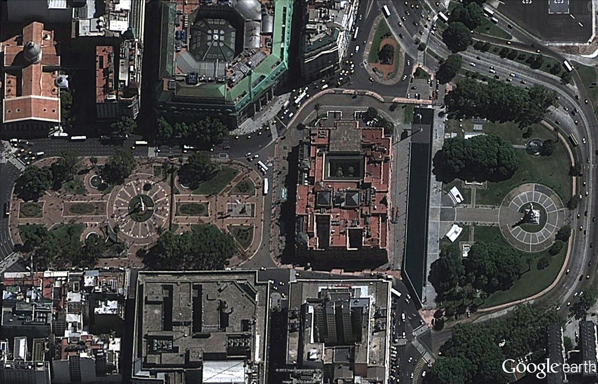
Google Earth is a digital mapping platform that allows users to explore satellite imagery, aerial photographs, terrain and three-dimensional models of locations around the world.
It is used by students, travelers, researchers, journalists, businesses and government agencies.
People often use the platform to examine property, monitor geographical changes, study historical development or understand events happening in distant places.
This reputation for accuracy makes AI-generated imagery particularly sensitive within Google Earth.
Users may approach a picture displayed in a creative design application with skepticism. They may be less suspicious of an image that appears to come from a widely trusted mapping platform.
Google promises stronger guardrails
Google said it had observed professionals using the AI feature for legitimate and useful projects.
However, it also found examples of people sharing generated material that appeared to violate company policies.
The company has not explained what additional safeguards it plans to introduce.
Possible measures could include more visible labels, permanent metadata, stricter limits on the types of scenes users can create or controls preventing certain images from being exported.
Google could also restrict editing around sensitive locations or block prompts involving violence, disasters and political events.
The company has not confirmed whether the Google Earth AI feature will return or when a revised version might become available.
AI image tools create growing challenges
Technology companies are rapidly adding image-generation systems to search engines, productivity software and consumer applications.
These tools can support design, education, entertainment and business planning. They can also create false visual evidence with little technical skill.
The Google Earth controversy shows that safeguards must consider the environment in which an AI tool operates.
A feature that is relatively harmless in a creative application may carry greater risks when placed inside a service associated with geographical accuracy.
Developers must also consider how generated material will be used after it leaves the original platform.
Google faces a difficult trust test
Google must balance the potential benefits of generative AI with its responsibility to protect the credibility of Google Earth.
Creative location editing could be useful for architects, property developers, historians and urban planners.
However, realistic fake satellite imagery could also become a powerful tool for deception.
Removing the Google Earth AI feature gave the company time to reconsider whether its original safeguards were strong enough.
Any future release will need to make generated images immediately recognizable, even when they are shared outside Google’s platforms.
The incident also highlights a wider problem facing the technology industry: creating AI content is becoming easier, but proving what is real is becoming harder.